Why has the western United States suddenly been shaking so violently over the past several weeks? On Tuesday, the constant barrage of headlines about the coronavirus pandemic was interrupted by an enormous earthquake that hit central Idaho. Of course Idaho is not exactly known for earthquakes, and so this was quite a surprise. In fact, the largest quake in Idaho history was the magnitude 6.9 Borah Peak earthquake in 1983. So when a magnitude 6.5 earthquake stuck not too far from Boise on Tuesday, it really stunned a whole lot of people. And according to the Spokesman-Review, this quake could be felt as far away as Calgary…
An earthquake hit southern Idaho on Tuesday afternoon, with shakes felt as far as Calgary, Canada, Boise and Spokane.
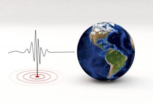
The United States Geological Survey measured a 6.5-magnitude earthquake at a depth of 10 miles just before 5 p.m. The center of the quake took place about 45 miles west of Challis, Idaho.
This is an event that those living up in the Northwest will remember for a long time to come. There was a tremendous amount of shaking all over the region, and according to at least one report some people actually “ran outside yelling”…
An entry in Volcano Discovery said: “Sustained moderate shaking for several minutes, Rumbling sound heard, people ran outside yelling. Knickknacks fell off shelf.
“Items suspended from ceiling/beams still slightly swaying 10 minutes later.”
All the way over in Helena, Montana someone described the shaking like being “on a small ship at sea during a storm”, and a restaurant owner in Stanley, Idaho reported that “the water next to me is still vibrating”…
The epicenter of this earthquake was approximately 78 miles from Boise and approximately 330 miles from Yellowstone.
Needless to say, any major seismic event anywhere near Yellowstone is a cause for concern.